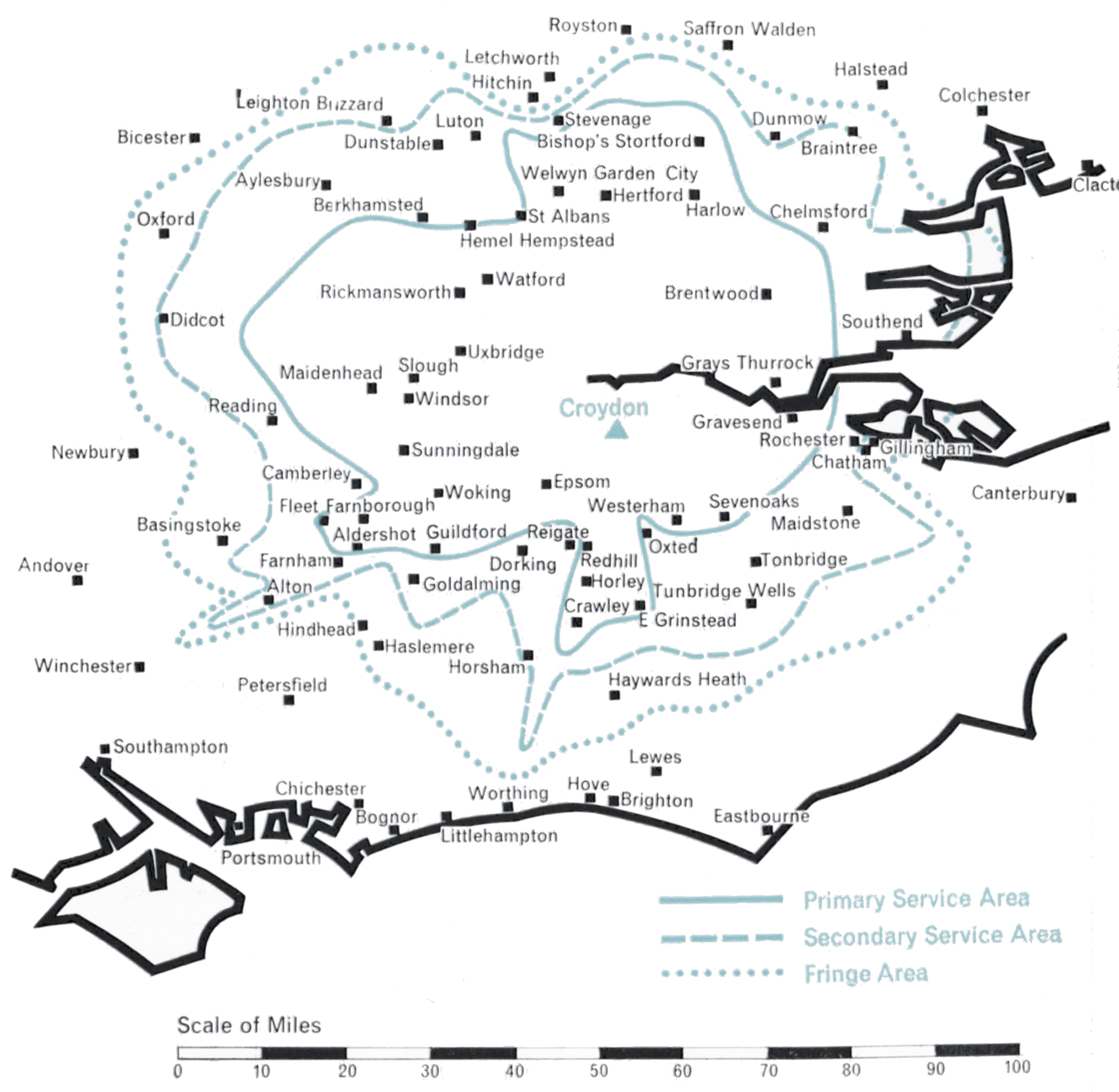
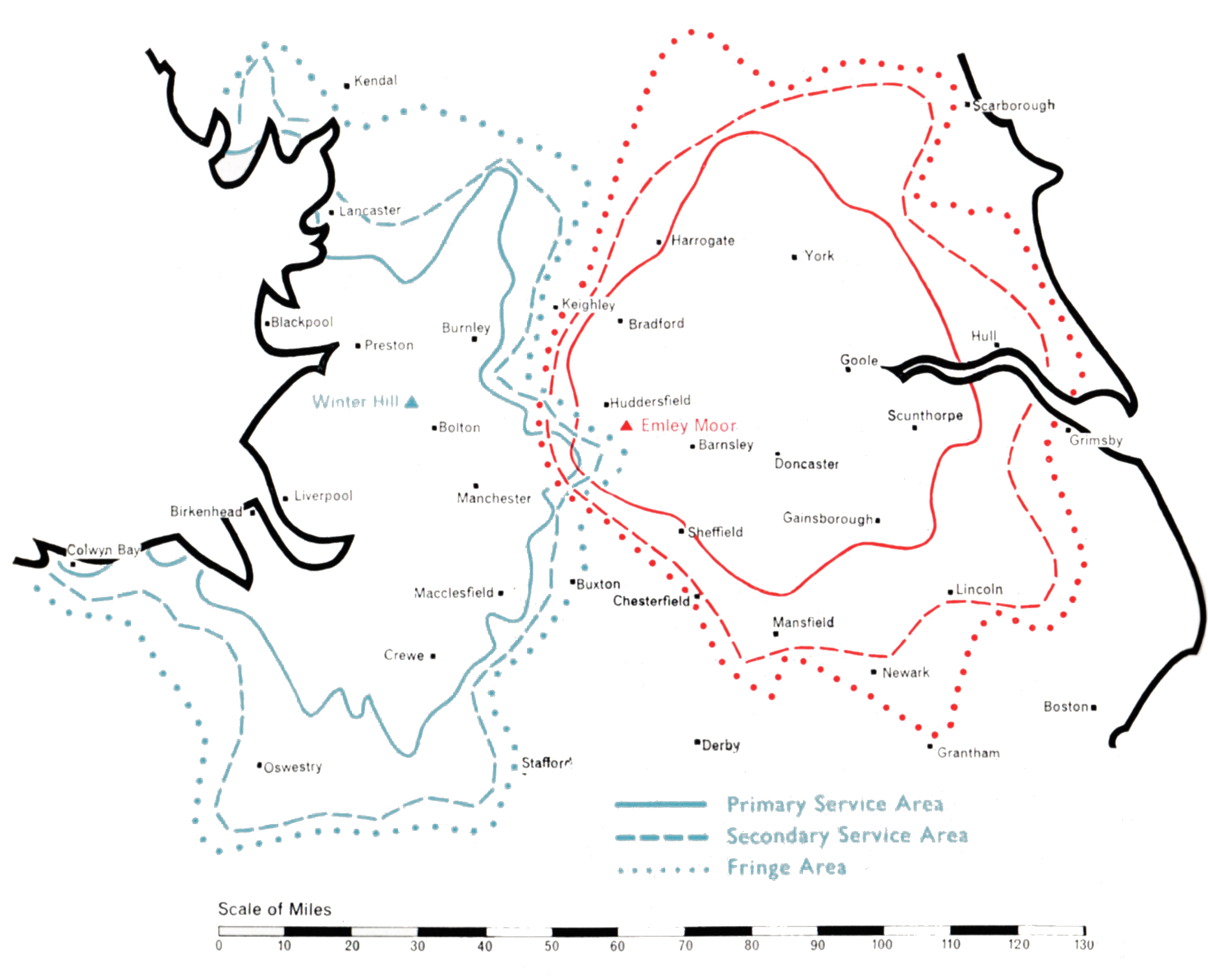
The following pages describe the coverage areas of the ITA’s transmitters, the varied problems which the Authority’s engineering staff have had to overcome in bringing Independent Television to each area of the country, and the technical details of the stations. The maps show the reception which should be available from each transmitter, on the following definitions:
PRIMARY SERVICE AREA
Within 2mV/m median contour
Where most viewers unless they are situated in particularly unfavourable positions should receive a consistently satisfactory service.
SECONDARY SERVICE AREA
Within ½mV/m median contour
Where a substantial proportion of viewers should receive a satisfactory service, but in a few unfavourably situated places reception may be poor.
FRINGE AREA
Within ¼mV/m median contour
Where acceptable reception should be secured in many locations, although this service may be subject to some interference from time to time. Some viewers living in favourable positions outside the Fringe Area may also receive a satisfactory service.
For the technical planner concerned with achieving national television coverage as economically as possible, London is the obvious point of departure. Within a radius of some forty miles from its heart live some twelve million people, almost one quarter of the total population of the United Kingdom. Topographically the London area presents no serious problem of propagation. It is relatively flat except for the North Downs some twenty-five miles to the south and the ridge of the Chiltern Hills some thirty miles to the west and north. Indeed, the difficulty is to find high ground close enough to the centre of London on which to construct a station. The choice rests between the 400 ft. ridges of Muswell Hill (Alexandra Palace) in North London and Sydenham (Crystal Palace) in South-East London.
Alexandra Palace was the BBC’s choice for their original Band I London station in 1935. Twenty years later, however, they were to move to a new station at Crystal Palace. In the interests of good planning the ITA decided to locate its first Band III station near this site, just a mile away on West Norwood Hill.
A suitable open space was found here for the construction of a small compact station which could be brought into operation with the least delay. The single 10 kW transmitter, the first Band III set constructed in this country, was a laboratory prototype and the aerial an experimental 8-stack omnidirectional vertically polarised array supported on a 200 ft. tower of virtually “stock” design. From this station on 22nd September 1955 the first programmes of Independent Television were transmitted. The effective radiated power was 60 kW (peak white vision), 15 kW (carrier sound). The potential population coverage was about 11 million people. After some months a second fully-engineered production 10 kW transmitter was installed as a standby. A little later, further equipment was installed to enable both sets of transmitters to be operated in parallel in order to double the station’s power.
It was realised that in due course the Croydon station must be given a higher tower and a new aerial system with directional characteristics tailored to give the optimum performance. Meanwhile, however, engineering effort was devoted to expanding the ITA network of stations to meet the fast-growing public demand for Independent Television programmes in other parts of the country. The completion of the BBC’s high tower at Crystal Palace allayed any fears that the mutual reflection of signals radiated from the two towers just a mile apart might be harmful to reception. Thus in February 1959 the Authority obtained Government approval to erect a higher tower and directional aerial at Croydon.
By the end of 1962 Croydon was transmitting from its slim new 500 ft. tower and radiating an effective power of about 400 kW directed to the north-west, with 5o to 100 kW e.r.p. in other directions, depending on the extent to which account had to be taken of the conflicting requirements of topography and co-channel interference with other ITA stations or with the television services of other countries. With its improved performance Croydon is bringing the programmes of Independent Television to a population of nearly 13 million in the London area, including some half a million viewers who have not before received any satisfactory ITV service.
The first proposal for covering the great Northern area with its population of about thirteen million was to build a high-power transmitting station close to the existing BBC Band I station at Holme Moss on the high central rib of the Pennine Chain. Studies showed that this would have been technically attractive had it been possible at that time, without a very considerable delay for special development, to provide an effective radiated power of about 500 kW with a mast height of at least 1,000 ft. Even so, severe fading would undoubtedly have been experienced at the fringes of the service area, on the west coast at Liverpool and on the east coast at Hull.
These and other considerations led the Authority to conclude that the area would be served best by two transmitting stations, one on the western slopes of the Pennines to serve Lancashire, Cheshire and parts of Staffordshire, and another on the east side of the Pennines to serve Yorkshire. The Postmaster-General agreed to this proposal, which constituted the first of several departures from the general principle that Band III stations should be sited close to existing Band I stations. The quality of service which has been given to the North of England as a result of this departure has fully justified the decision. Winter Hill, the Lancashire station, was constructed on the summit of Rivington Moor, a fine site 1,450 feet above sea level. The aerial, which is carried on a self-supporting 450 ft. tower radiates 100 kW omnidirectionadly. Construction work began in September 1955 and the station went into programme service on 3rd May 1956.
Winter Hill
The selection of the site for the Yorkshire station posed considerable problems largely because coverage of the main concentration of population within the hill-shadowed towns of the West Riding had to be combined with the provision of a service as far away as Kingston-upon-Hull some 5o miles away across the Yorkshire Plain.
Sixteen different sites were studied theoretically and tests, using a balloon transmitter, were made at four of them before Emley Moor, 850 feet above sea level on the eastern slopes of the Pennine Chain, was finally selected. Once again, because of the small area available, a 450 ft. tower was used to support the aerial, which has a semicircular power-radiation pattern delivering 200 kW e.r.p. in all easterly directions but only a few kilowatts backwards to the west into the natural barrier of the Pennines, thus preventing waste and an unnecessary overlap with the service area of the Winter Hill station. Emley Moor went into service on 3rd November 1956.
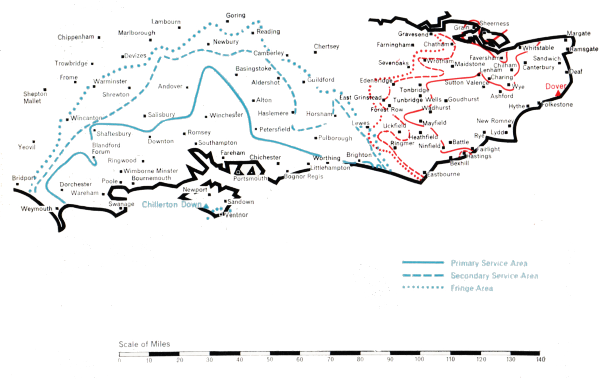
Chillerton Down was the first of the two stations built to serve the south and south-east coastal areas of Britain. It was designed to cover central southern England, the important agricultural and holiday area along the coast from Weymouth in the west to Brighton in the east, together with the great ports of Southampton and Portsmouth and, inland, the county of Hampshire and adjoining parts of Dorset and Wiltshire. A BBC Band I station existed at Rowridge, on the Isle of Wight. In conformity with the Government’s policy the Authority decided if possible to build its Band III station close to Rowridge. The site selected was on Chillerton Down, 550 ft. above sea level on the south side of the island. Opposition to a second television mast on the island was raised on grounds of amenity. However, the alternative of building at Rowridge a more massive and commanding tower to carry both the ITA and BBC television services and the BBC’s VHF sound services proved even less welcome, and the Authority’s proposal to use Chillerton Down for a slim 750 ft. mast was accepted.
Chillerton Down
The transmitting aerial has a semicircular power-radiation pattern, oriented to direct 100 kW in both directions along the coast as well as landwards, but radiating very low power across the English Channel to prevent interference with the services of Radiodiffusion-Télévision Francaise. Chillerton Down went into service on 30th August 1958 and serves the intended area well.
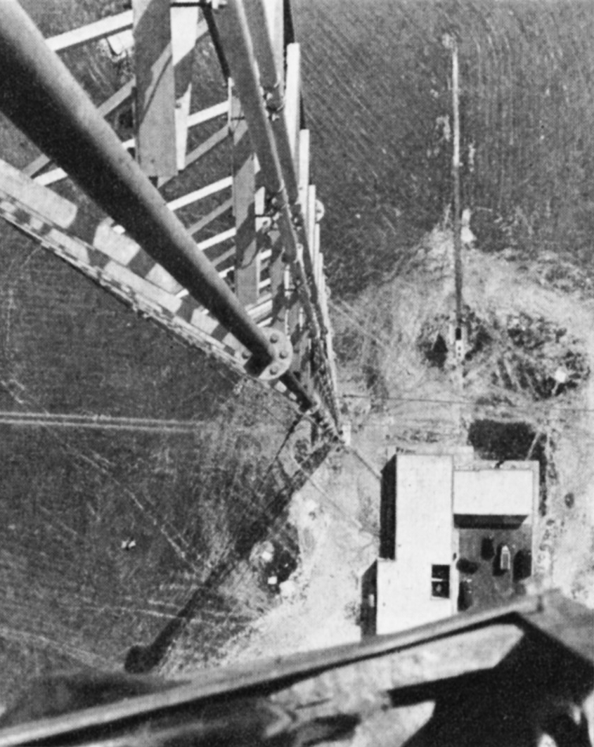
The sister station at Dover presented unusual problems. The general requirement was to serve the south-east corner of England not covered by Chillerton Down or Croydon. The site of the station was determined by the need to serve Folkestone and Dover, which lie at sea level under high cliffs. The solution was to build the station on the high cliff road linking the two towns. Church Hougham, 450 feet above sea level, was used and from a 750 ft. mast a signal could be directed into both towns. At the same time the station had to link up with the service area of Chillerton Down beyond Eastbourne, 5o miles west along the coast. 100 kW was sufficient to provide an adequate service for Eastbourne and the intermediate coastal towns, and there were no inhibiting power restrictions. Northward, to serve the towns on the Thames estuary not covered by Croydon, 10 kW to 20 kW e.r.p. was adequate. However, viewers in France had to be protected from interference to their reception of the signal from the Rouen station. Calculations showed that Dover must restrict its power to less than 1 kW over an arc of 90° towards the French Coast. It was no mean task to construct a transmitting aerial to do this, and at the same time to radiate 100 kW westward. Test transmissions were made for many weeks, during which the Authority’s engineers developed a measuring technique, using a helicopter, to check the the radiation pattern of the transmitting aerial. This difficult operation accomplished, Dover went into service on full power on 31st January 1960.
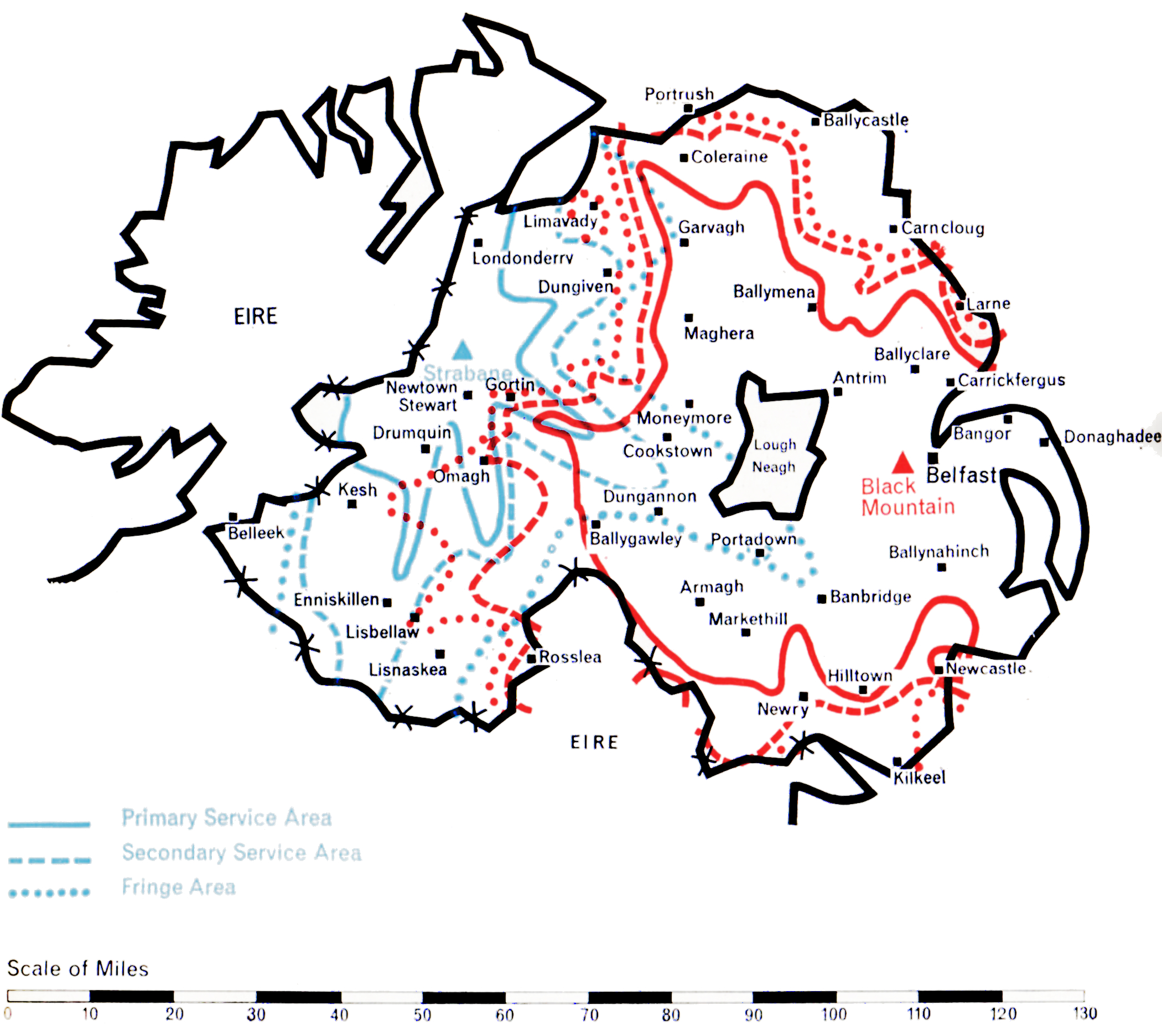
A large part of Northern Ireland was provided with an Independent Television service in the Autumn of 1959 by the construction of the Black Mountain station near Belfast, close to the BBC’s existing Band I station at Divis. However, West Ulster, which includes the districts of Londonderry and Enniskillen, could not be covered by this station and, clearly, at least one additional station was needed.
The Black Mountain station overlooks Belfast and is 987 ft. above sea level. A 750 ft. mast, the highest permitted by the Ministry of Transport and Civil Aviation due to the proximity of the airport, was erected. It supports a moderately-directional aerial radiating about 100 kW to both the north-west and the south-west, 7o kW to the west and 20 kW to the east. This power-radiation pattern ensures the optimum coverage of the area whilst avoiding harmful interference to the service areas of other stations using Channel 9, notably Winter Hill.
Black Mountain
A study of the topography of West Ulster revealed that the unserved area could economically be covered by a single station if a high site near Strabane could be obtained. A site 900 ft. above sea level was found four miles south-east of Strabane and here a station using a 1,000 ft. mast was constructed.
It has a highly-directional aerial radiating about 9o kW in two main lobes to the north and to the south. 10 kW only is radiated to the east and west, but this suffices to cover the areas not served by the Black Mountain transmitter and, at the same time, prevents unnecessary radiation into the territory of the Irish Republic to the west.
The Black Mountain station went into service on 31st October 1959. Strabane began programme transmission during February 1963.
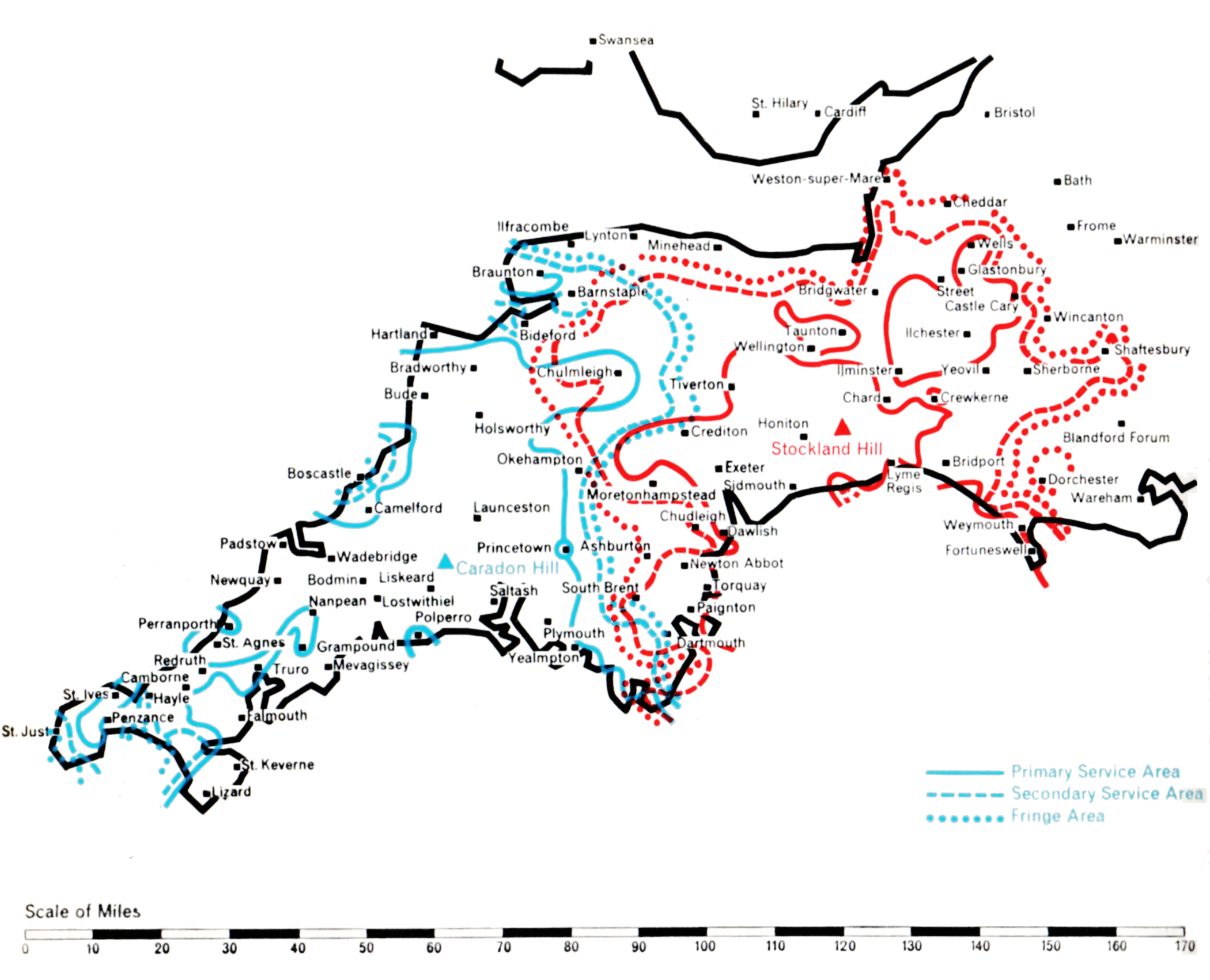
Propagation studies of the best method of covering the 150 mile long wedge-shaped area of Devon and Cornwall showed that it was not practical to serve it adequately from a single Band III station centrally situated on the heights of Dartmoor, adjacent to the BBC’s station at North Hessary Tor. Government agreement was obtained to build two stations, one in Cornwall and one in South Devon, another necessary departure from the principal of co-siting with the BBC Band I station.
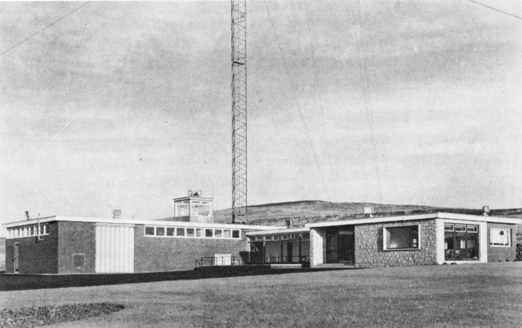
High sites were found at Caradon Hill, near Launceston, for Cornwall; and at Stockland Hill, near Axminster, for Devon. Transmitting aerials with highly-directional lobes were engineered to give the desired grade of service to both areas while minimising interference with other ITA and Continental stations which use the same channels. Each station needed a 750 ft. mast to minimise “shadows” in this hilly terrain.
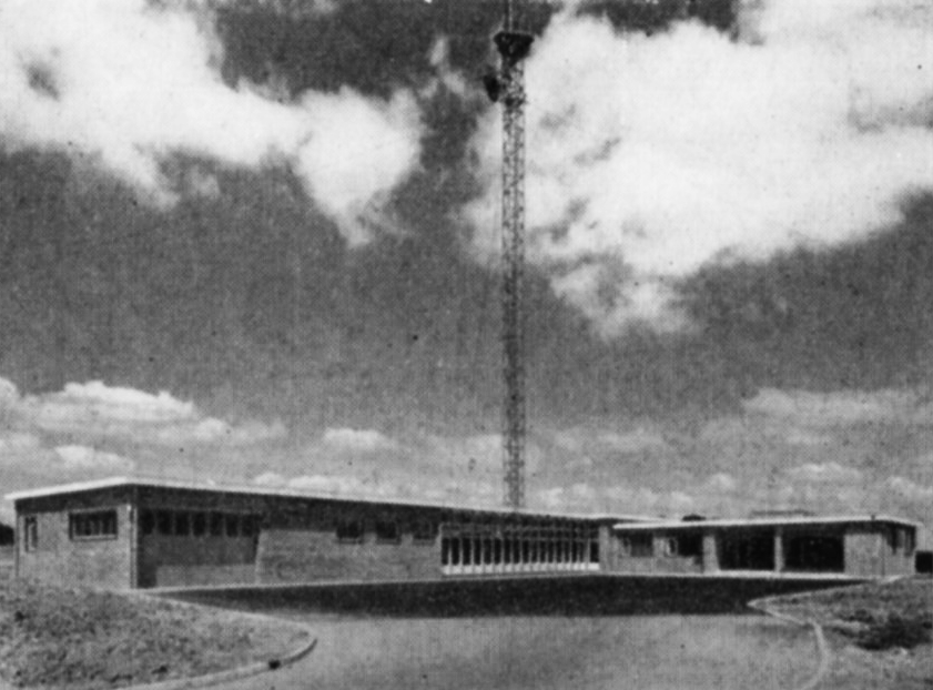
Stockland Hill
For Caradon Hill, the requirement was to give a service to the whole of Cornwall west of Dartmoor and reaching to the extremity of England at Land’s End. A power of 200 kW e.r.p. was beamed in this direction but to avoid interference in the service area of the Dublin station the power over an arc of 40° to the north-west had to be restricted to a mere 10 kW, while to the south the power had to be restricted to 25 kW to avoid interference in the service area of the Cherbourg station.
Studies showed that in order to cover Devon while not overlapping unnecessarily with the existing service area of St. Hilary, Stockland Hill should direct its maximum power in two lobes, one north-west towards Barnstaple and the other south-west towards Dartmouth. 100 kW was the maximum permissable radiated power but restriction to 10 kW eastwards was necessary to prevent interference in the London area, which also uses Channel 9. The shape of the aerial radiation pattern thus became that of a boomerang facing westwards
A subsidiary beam of about 5o kW directed south-east towards the island of Alderney was also desirable to ensure reliable reception of the Stockland Hill signal in the island, in order to relay the mainland programmes by Post Office microwave link to the Fremont Point station in Jersey for rebroadcasting in the Channel Islands. However, the service area of the existing French station at Bourges had to be protected and the power radiated towards Alderney was restricted to 20 kW. Fortunately, in practice, this power is just sufficient for the Stockland Hill signal to be received in Alderney, with a signal to noise ratio good enough for rebroadcasting from the Fremont Point station. Both stations went into service on 29th April 1961.
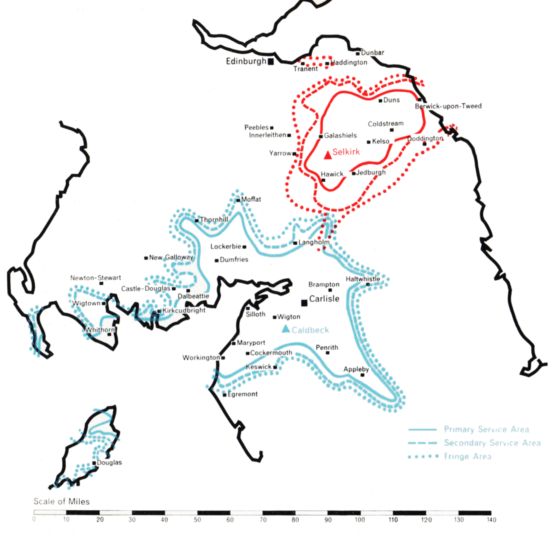
The Border country has two well-populated areas separated by the high sparsely-populated Cheviot Hills. That in the west extends north and south of the Solway Firth and includes the towns of Carlisle, Penrith and Dumfries. The other, in the east, embraces the Valley of the Tweed, and includes Selkirk and the coastal town of Berwick-on-Tweed.
Planning studies indicated that the best way of serving the pupulated areas was to build two separate stations, one near Carlisle and one near Selkirk. The site chosen for the first station was at Caldbeck, 940 ft. above sea level and some 10 miles west of Carlisle, in the foothills of the Cumbrian Mountains. Caldbeck lies somewhat to the south of the area to be served and a directional transmitting aerial supported on a 1,000 ft. mast was provided to radiate the maximum power of 100 kW to the northeast and the south-west, about 7o kW to the north-west across the Solway Firth, but only 20 kW to the south-east. In this direction the useful signal would naturally be blocked by mountainous country, which would not, however, prevent an interfering signal from penetrating into the service area of Mendlesham (which uses the same channel) some 200 miles distant, unless power in that direction were appropriately restricted.
Caldbeck
The second station was built on Lindean Moor, 944 feet above sea level and close to Selkirk. It has a 750 ft. mast and an aerial which radiates its effective power of 25 kW mainly eastwards towards the coast. This provides a good secondary service in Berwick-on-Tweed, whilst the numerous small towns of the Tweed Valley all receive a primary service.
The Selkirk station is a satellite of Caldbeck. It obtains its programmes by direct radio pick-up from Caldbeck and rebroadcasts them on a different channel. It is the first of a number of unattended remotely-controlled satellite stations of medium to low power to be constructed by the Authority.
Caldbeck began programme service on 1st September 1961 and Selkirk on 1st December in the same year, and both well fulfil the purpose for which they were designed.
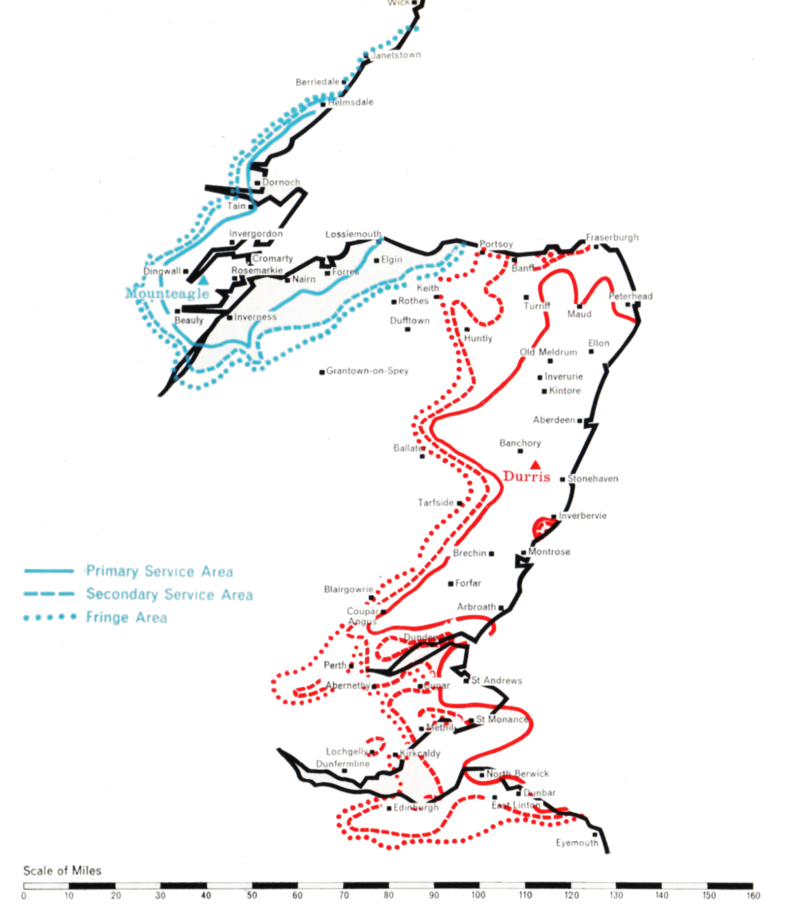
Two stations were necessary to cover North-East Scotland, one of medium power to serve the Inverness area and another of high power to cover Aberdeenshire and as much of Angus as possible. The main problem was to find the best site for the high-power station, which was not necessarily that of the existing BBC Band I station at Meldrum, north-west of Aberdeen.
Mounteagle
For the Inverness area, a site was found at Mounteagle 730 ft. above sea level, on the Black Isle, about eight miles north of Inverness and close to the Band I station at Rosemarkie. An 800 ft. mast was used, and the maximum power of 5o kW was radiated in two directions, slightly east of north and east of south respectively. 35 kW is radiated in the direction of Lossiemouth eastwards along the Morayshire coast. Only 10 kW is radiated to the west, over the uninhabited mountainous areas of Ross and Cromarty.
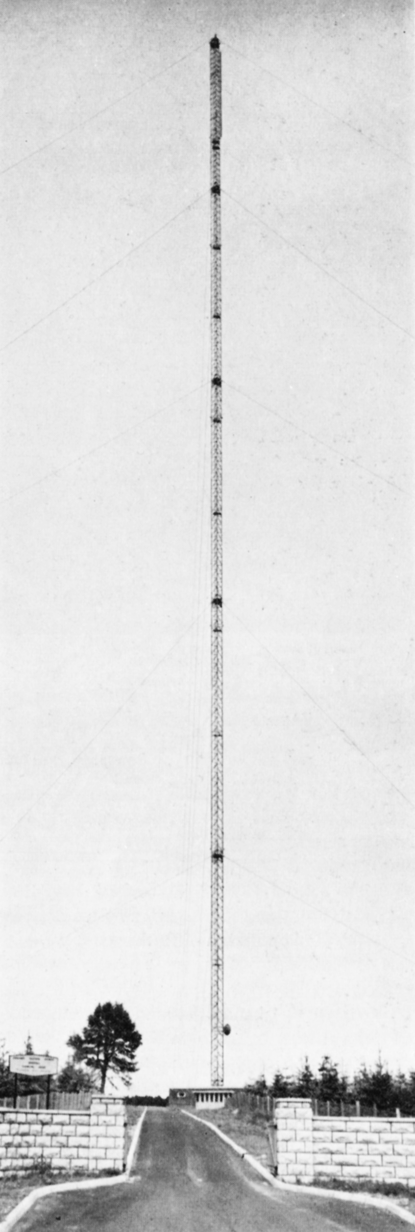
Choosing the site for the high-power station to serve Aberdeen/Angus was more difficult because it was decided to try to cover the whole coastal area from Peterhead on the Moray Firth in the north to Arbroath on the Firth of Tay in the south, a distance of some 100 miles, and to include those parts of Dundee which did not receive a satisfactory service from Black Hill. A site at Durris, 1,o5o ft. above sea level, exposed, difficult of access and some 15 miles South of Aberdeen was selected. A 1,ooo ft. mast was used. Once again this choice involved a departure from the principle of adjacent siting with existing Band I stations.
The Durris station beams its power in two main lobes, each of 400 kW, one directed to the north and the other to the south-west, towards Dundee. Both stations went into service on 30th September 1961, and together cover satisfactorily the large area they were planned to serve.
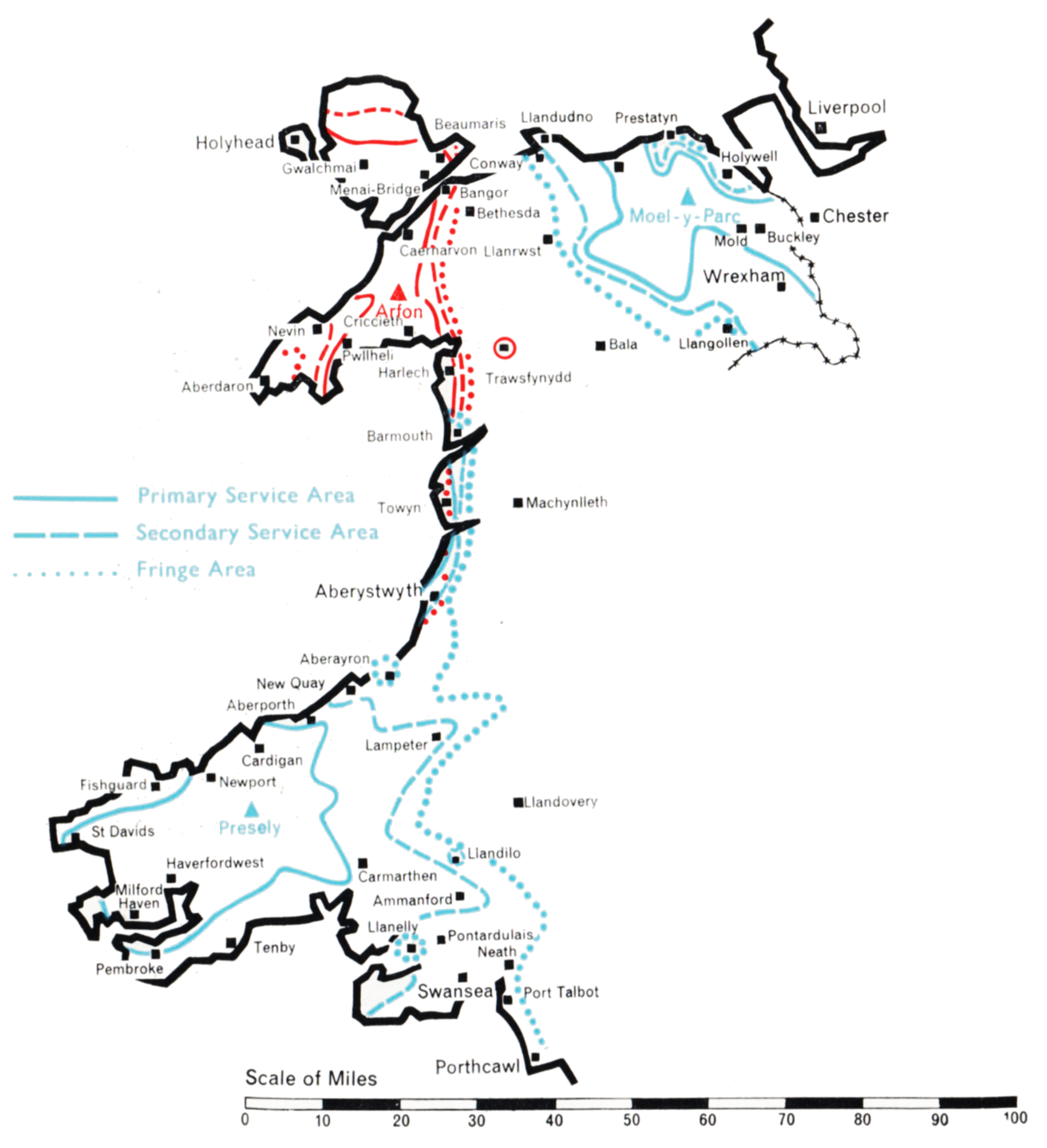
This group of stations was planned to bring Independent Television programmes to the Welsh-speaking populations of West and North Wales, including the area bordering on Cheshire which contains the towns of Denbigh, Mold and Wrexham. The populated areas are mainly along the west coast from Pembroke to Anglesey, and on the north coast from Conway and Llandudno to Prestatyn.
The technical problem was unusually complicated. It has been solved by the establishment of three stations, one on the Prescelly mountains in Pembrokeshire, one on the Lleyn Peninsula, and one on the Clwydian Range of mountains in the Flint-Denbigh area. This plan departed considerably from an earlier one based on sites previously selected for BBC Band I stations.
Presely
A site for the Presely station was found at Foel Drych 1,100 ft. above sea level, where a 770 ft. mast was sufficient to give the required coverage, although the radiation pattern of the transmitting aerial had to be extremely complicated. A narrow beam radiating 8o kW to the north was required to ensure a reliable programme link to the Arfon relay station. A beam of 100 kW to the south-east, in the direction of Carmarthen and Llanelly, was necessary to ensure that the service area of Presely joined that of St. Hilary; and a broad lobe of 5o kW to the south-west was needed to serve Pembrokeshire. At the same time severe power restrictions had to be incorporated in several directions to avoid co-channel interference in the service areas of the ITA’s transmitters at Strabane, Burnhope and Lichfield, the Kilkenny station of the Irish Republic, and the French stations serving the coast of Brittany. Intensive development was necessary to construct an aerial with this complicated radiation pattern.
The unattended Arfon station, which rebroadcasts the Presely transmissions, is at Bryn-ychain, ten miles south of Caernarvon, 950 ft. above sea level. A 1,ooo ft. mast was used to “see” over the mountains of Portmadoc to the coast of Cardigan Bay from Harlech to Barmouth, and to ensure the link with the service area of Presely. A directional aerial was again necessary. 10 kW is radiated to the north and south-west, 5 kW to the east and south-east, and 2.5 kW to the west.
The third station is at Moel-y-Parc, a peak in the Clwydian Range 1,100 ft. above sea level, and serves the North Wales area. A 750 ft. mast was found adequate to reach the coastal resins from Conway to Prestatyn, which are shielded by mountains close to the coast. The radiation pattern of the transmitting aerial is approximately semicircular, 25 kW being radiated from south-east to north-west with reduced power to the north and east. This was necessary to cover the Welsh areas but to avoid overlap with English areas already served by Winter Hill. Moel-y-Parc rebroadcasts the transmissions from the Arfon station, conveyed to it by an off the air pick-up at Nebo, in Anglesey, followed by a microwave link.
All three stations for the west and north of the Principality were in programme service by early 1963.
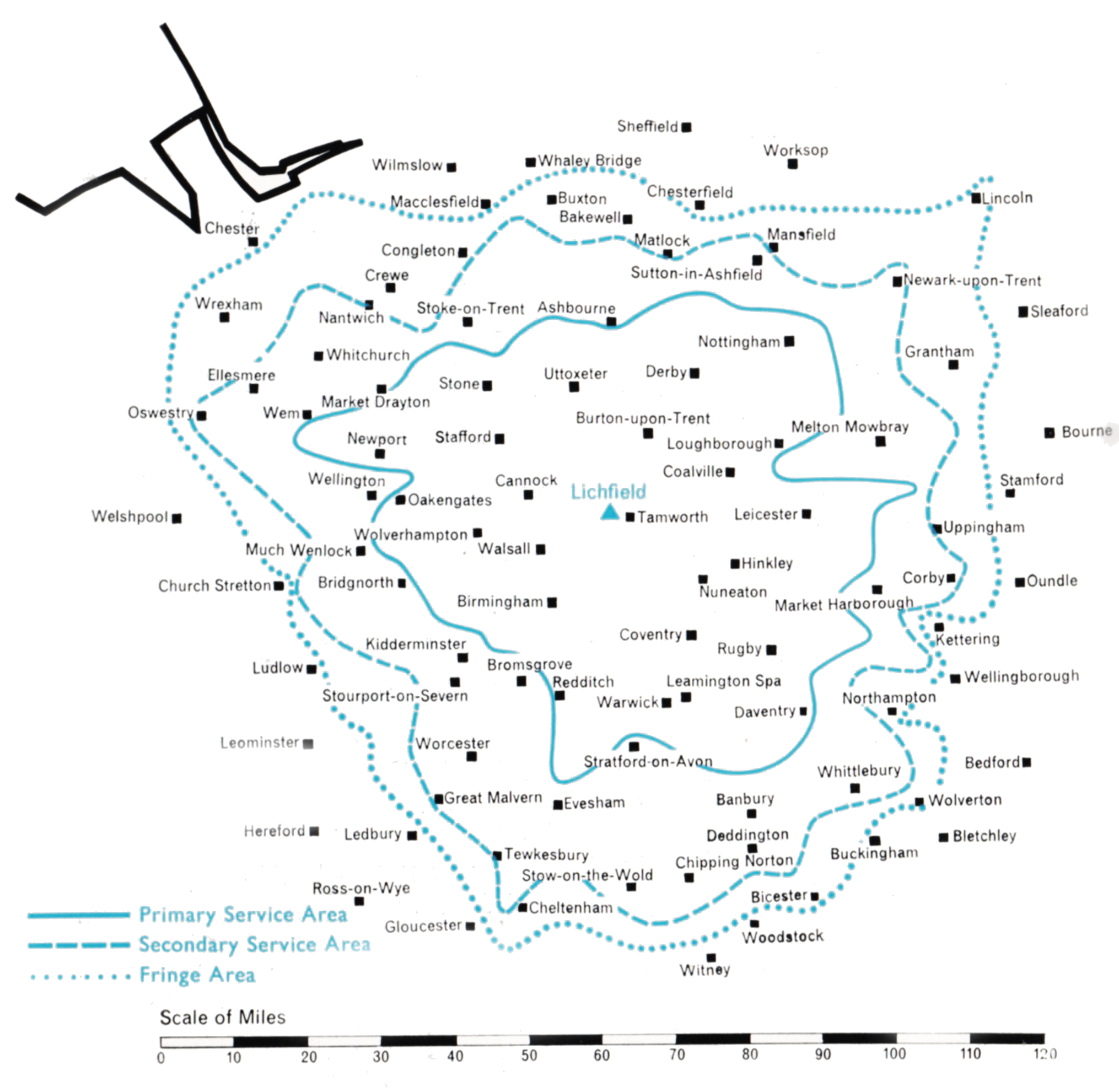
Geographically, the siting of a station to serve the industrial Midlands proved fairly straightforward, because the service area of the BBC’s Band I station at Sutton Coldfield corresponded closely with that which the Authority also wished to achieve. High open ground in the area is scarce and, with reason, carefully protected. It was not therefore easy to find an acceptable site. A piece of land 500 ft. above sea level, about four miles north-east of the BBC station, was eventually secured. It lies near the Watling Street in the rural district of Lichfield, from which the station derives its name.
Initially, an available design of 450 ft. self-supporting steel tower was erected, carrying an omnidirectional aerial similar to the one used at Croydon but of twice the aperture. This enabled a service to be provided quickly. The station went into programme service on 17th February 1956 with a single 5 kW transmitter, giving an effective radiated power of 6o kW. A few months later the power was raised to 120 kW by paralleling two 5 kW sets into the split aerial. In November of the same year, after the main 20 kW transmitter had been installed, the power was raised to 200 kW e.r.p. This gave a population coverage of nearly 6.5 million within the o.25 mV/m contouur. From the start it was recognised that, because of the relatively low site, greater and more uniform coverage could be obtained with a higher mast and an aerial system with directional characteristics. Sufficient land was therefore acquired to permit this to be done later.
Early in 1961 it became possible to start the construction of a 1,000 ft. mast and an improved aerial. Both these were brought into service in July of the same year, thus allowing the original tower to be dismantled and re-erected for use at the Fremont Point station in the Channel Islands. The new aerial enabled the power radiated south towards Gloucester to be increased to 400 kW.
Towards East Anglia, however, the power had to be reduced to 100 kW to prevent harmful interference to viewers of the Netherlands Television Service on the Dutch coast. For this reason, the service to Midlands viewers living east of the station remained substantially unchanged. Over a semi-circle towards the north the radiated power was maintained at 200 kW. This was sufficient, with the higher aerial, to close the gaps between the service areas of Lichfield and the Winter Hill and Emley Moor stations. The effect of the new mast and aerial was a general all-round improvement in reception, both within the old service area and beyond. The predicted coverage is shown in the map opposite. The measured coverage has recently been completed and includes a population of 8.85 million within the 0.25 mV/m contour.