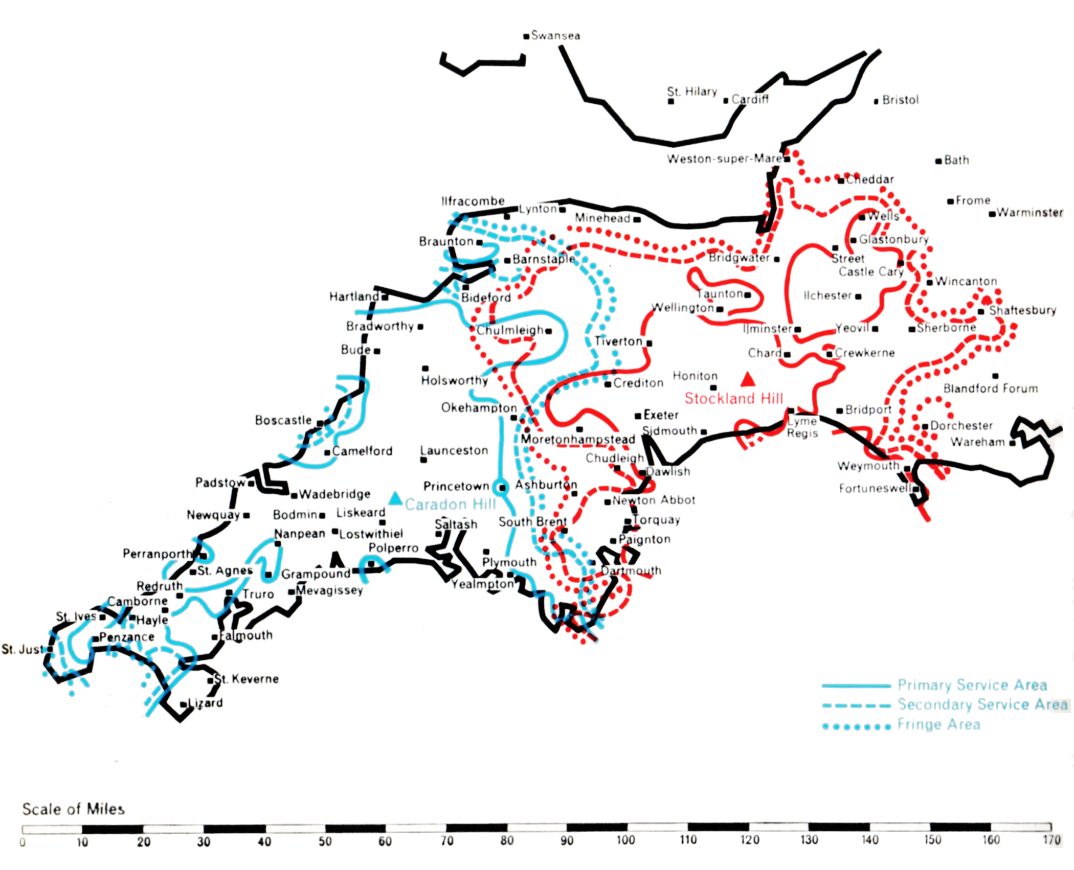
- CARADON HILL
- Population within measured contours: Primary 0.518 mn, Secondary 0.159 mn, Fringe 0.053 mn. Total 0.73 mn.
- Channel: Band III Channel 12 (vertically polarised)
- Vision Carrier Frequency: Nominal 209.75 Mc/s. Actual 209.74325 Mc/s
- Sound Carrier Frequency: Nominal 206.25 Mc/s. Actual 206.23 Mc/s
- Effective Radiated Power: Vision 200 kw maximum. Sound 50 kw maximum.
- Power of Transmitters: Vision (peak white) 2 x 5 kW. Sound (carrier) 2 x 1.25 kW
- Heights above sea level: Site 1,215 ft. Mean aerial 1,925 ft.
- Location: 4° 26′ 8″ W, 50° 30′ 39″ N.
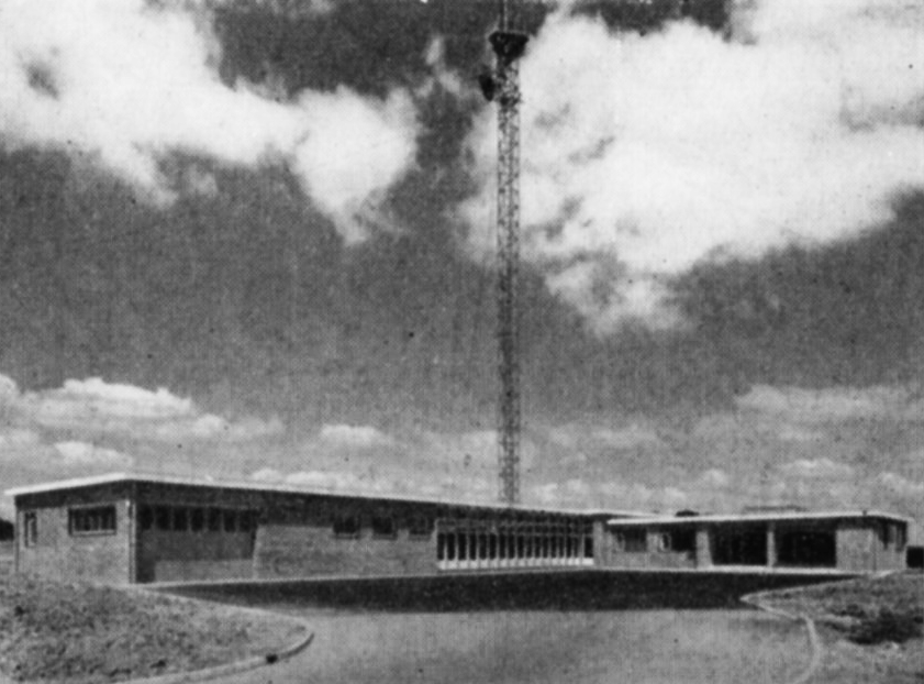
- STOCKLAND HILL
- Population within measured contours: Primary 0.362 mn, Secondary 0.405 mn, Fringe 0.148 mn. Total 0.915 mn.
- Channel: Band III Channel 9 (vertically polarised)
- Vision Carrier Frequency: Nominal 194.75 Mc/s. Actual 194.74325 Mc/s
- Sound Carrier Frequency: Nominal 191.25 Mc/s. Actual 191.234 Mc/s
- Effective Radiated Power: Vision 100 kw maximum. Sound 25 kw maximum.
- Power of Transmitters: Vision (peak white) 2 x 5 kW. Sound (carrier) 2 x 1.25 kW
- Heights above sea level: Site 750 ft. Mean aerial 1,460 ft.
- Location: 3° 6′ 13″ W, 50° 48′ 23″ N.
Stockland Hill (Channel 9) and Caradon Hill (Channel 12)
Company: Westward Television
Propagation studies of the best method of covering the 150 mile long wedge-shaped area of Devon and Cornwall showed that it was not practical to serve it adequately from a single Band III station centrally situated on the heights of Dartmoor, adjacent to the BBC’s station at North Hessary Tor. Government agreement was obtained to build two stations, one in Cornwall and one in South Devon, another necessary departure from the principal of co-siting with the BBC Band I station.
High sites were found at Caradon Hill, near Launceston, for Cornwall; and at Stockland Hill, near Axminster, for Devon. Transmitting aerials with highly-directional lobes were engineered to give the desired grade of service to both areas while minimising interference with other ITA and Continental stations which use the same channels. Each station needed a 750 ft. mast to minimise “shadows” in this hilly terrain.
For Caradon Hill, the requirement was to give a service to the whole of Cornwall west of Dartmoor and reaching to the extremity of England at Land’s End. A power of 200 kW e.r.p. was beamed in this direction but to avoid interference in the service area of the Dublin station the power over an arc of 40° to the north-west had to be restricted to a mere 10 kW, while to the south the power had to be restricted to 25 kW to avoid interference in the service area of the Cherbourg station.
Studies showed that in order to cover Devon while not overlapping unnecessarily with the existing service area of St. Hilary, Stockland Hill should direct its maximum power in two lobes, one north-west towards Barnstaple and the other south-west towards Dartmouth. 100 kW was the maximum permissable radiated power but restriction to 10 kW eastwards was necessary to prevent interference in the London area, which also uses Channel 9. The shape of the aerial radiation pattern thus became that of a boomerang facing westwards
A subsidiary beam of about 5o kW directed south-east towards the island of Alderney was also desirable to ensure reliable reception of the Stockland Hill signal in the island, in order to relay the mainland programmes by Post Office microwave link to the Fremont Point station in Jersey for rebroadcasting in the Channel Islands. However, the service area of the existing French station at Bourges had to be protected and the power radiated towards Alderney was restricted to 20 kW. Fortunately, in practice, this power is just sufficient for the Stockland Hill signal to be received in Alderney, with a signal to noise ratio good enough for rebroadcasting from the Fremont Point station. Both stations went into service on 29th April 1961.