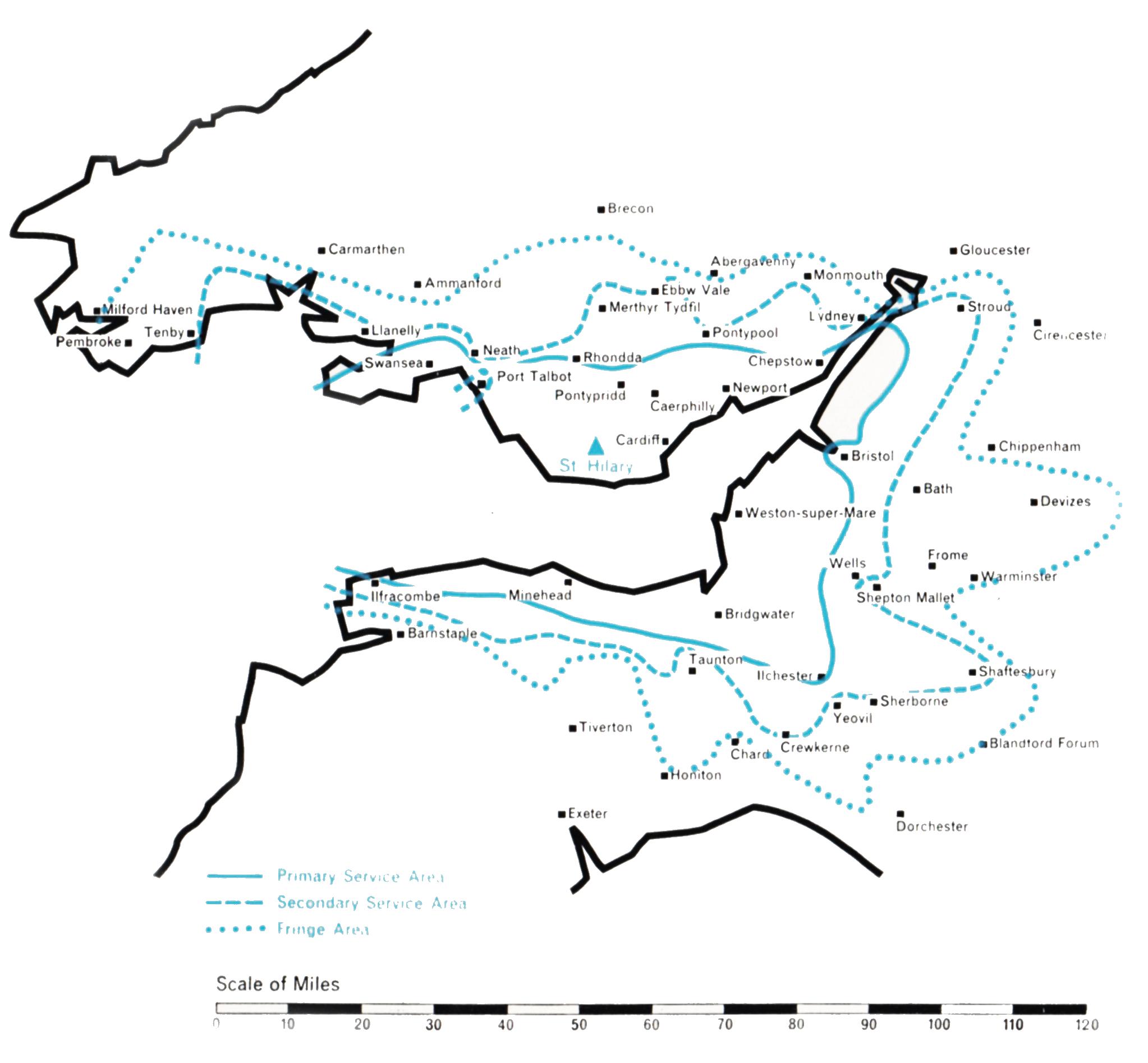
- Population within measured contours: Primary 1.517 mn, Secondary 1.0 mn, Fringe 0.77 mn. Total 3.287 mn.
- Channel: Band III Channel 10 (vertically polarised)
- Vision Carrier Frequency: Nominal 199.75 Mc/s. Actual 199.7305 Mc/s
- Sound Carrier Frequency: Nominal 196.25 Mc/s. Actual 196.2395 Mc/s
- Effective Radiated Power: Vision 200 kw maximum. Sound 50 kw maximum.
- Power of Transmitters: Vision (peak white) 20 kW. Sound (carrier) 5 kW
- Heights above sea level: Site 400 ft. Mean aerial 1,100 ft.
- Location: 3° 24′ 15″ W, 51° 27′ 25″ N.
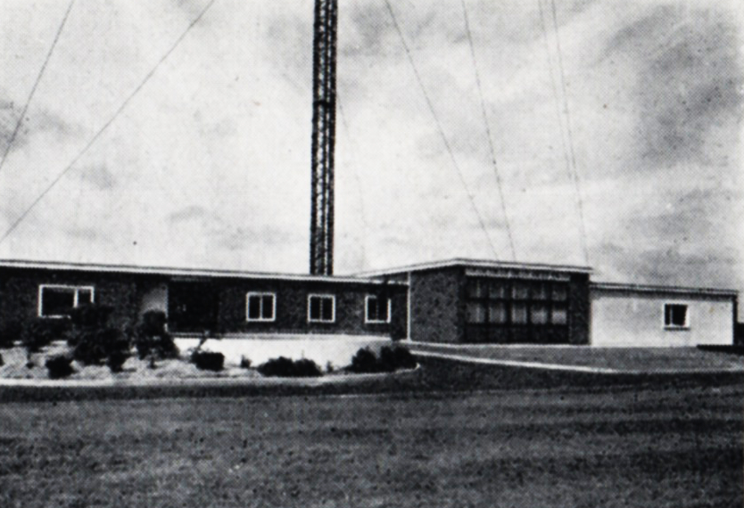
St. Hilary (Channel 10)
This station brings the Independent Television programmes to the Welsh and English populations adjacent to the Severn Estuary and the Bristol Channel. With the limited number of Band III channels available to the Authority, each one had to be used to serve the maximum possible geographical area. In May 1955, studies were begun to determine which of a number of approaches to the problem of covering South Wales, North Somerset and North Devon was the best. The coverage potential of sites to the south of the Estuary in the Mendips and the Quantocks, as well as on the north shore in various parts of South Wales, was investigated.
A site was selected at St. Hilary Down, on the Welsh side of the estuary, between Cardiff and Swansea, and 400 ft. above sea level. This gave the maximum potential population coverage of the densely populated areas of industrial South Wales and Monmouthshire, and was adjacent to the BBC Band I station at Wenvoe a few miles to the east, serving broadly the same geographical area.
 The mast height at St. Hilary is 750 ft. The Authority would have preferred 1,000 ft., but air navigation considerations precluded this. Even so, approval for the site had to be withheld by the Glamorgan County Council pending a public enquiry, held in March 1957, to resolve the objections to the mast lodged by the airline companies operating from the nearby Rhoose Airport. The effective radiated power is 200 kW omni-directional, because directional characteristics would have been of little avail in improving the service for the many valleys of South Wales, which radiate northwards like spokes of a wheel from the “hubs” of Cardiff and Newport.
A major redesign of the aerial system had to be undertaken, because the intended “inside the mast” type of aerial, the prototype of which had just been tested at the Black Hill station in Scotland, had been found to be deficient.
The station was opened for programmes, with an aerial of more conventional design, on 14th January 1958. It has given the high grade of service predicted, but the fundamental limitations of Band III transmission and reception in mountainous terrain when compared with Band I led to some public disappointment about the comparative grades of service in some shielded locations in the deep valleys of South Wales and also in low-lying parts of the cities of Bristol and Bath. The use of well designed receiving aerials and of more sensitive “fringe area” receivers has overcome, in part, the low signal strength and the “ghost” images experienced in such localities.

 ABC TELEVISION Ltd.
 ANGLIA TELEVISION Ltd.
 ASSOCIATED-REDIFFUSION Ltd.
 ASSOCIATED TELEVISION Ltd.
 BORDER TELEVISION Ltd.
 CHANNEL TELEVISION Ltd.
 GRAMPIAN TELEVISION Ltd.
 GRANADA TV NETWORK Ltd.
 SCOTTISH TELEVISION Ltd.
 SOUTHERN TELEVISION Ltd.
 T W W Ltd.
 TYNE TEES TELEVISION Ltd.
 ULSTER TELEVISION Ltd.
 WALES (West & North) TELEVISION Ltd.
 WESTWARD TELEVISION Ltd.
 INDEPENDENT TELEVISION NEWS Ltd
 INDEPENDENT TELEVISION COMPANIES ASSOCIATION